Emergency Management Planning
Comprehensive mapping & GIS resources for disaster mitigation, response, and recovery.
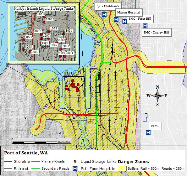
Flooding Analysis: Impacted Land Cover
Flooding of the Congaree River during H. Joaquin (Columbia, SC in Oct 2015).
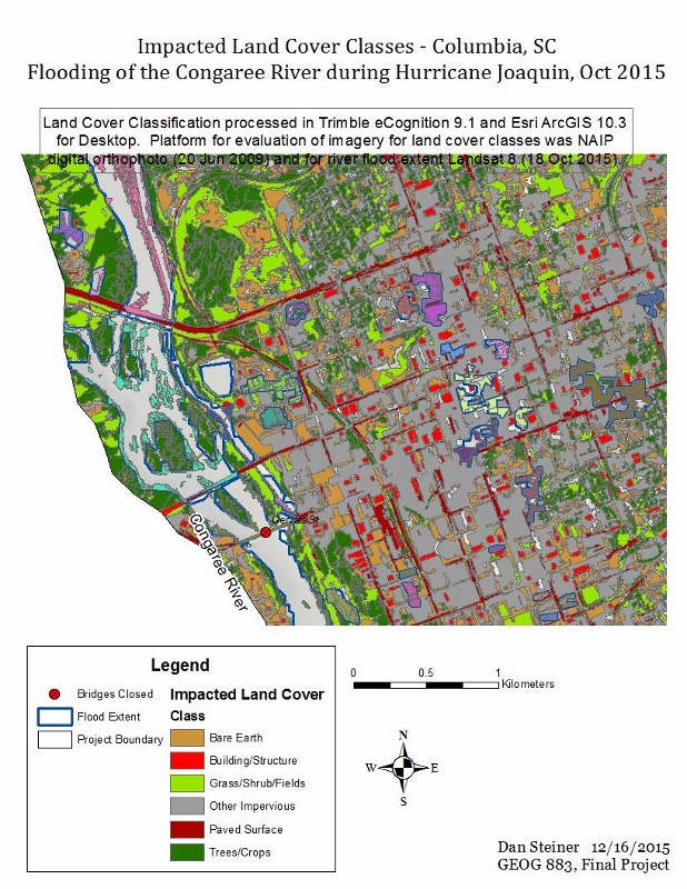
Flooding Analysis: Terrain Analysis
Flooding of the Congaree River during H. Joaquin (Columbia, SC in Oct 2015).
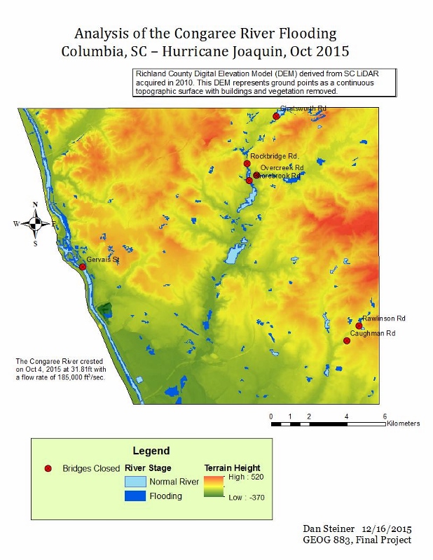
Flooding Analysis: Land Cover
Flooding of the Congaree River during H. Joaquin (Columbia, SC in Oct 2015).
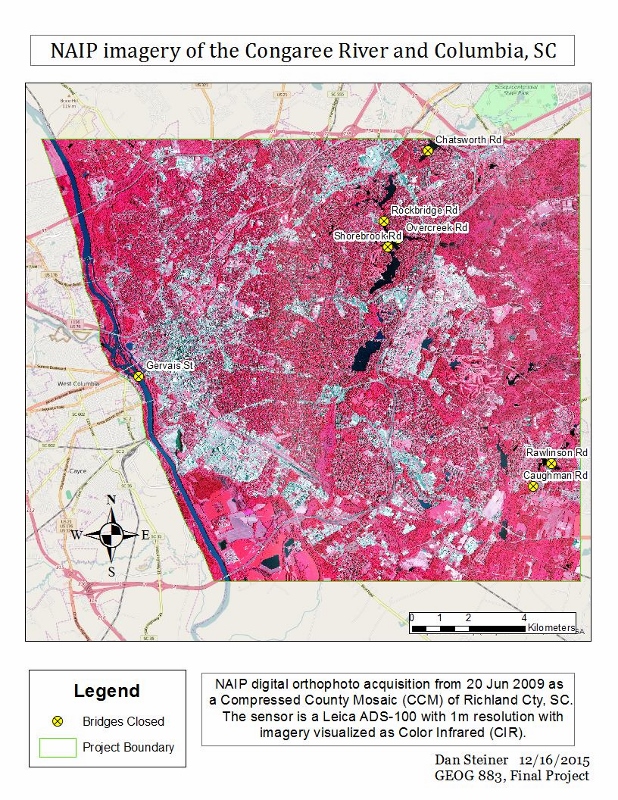
Flooding Analysis: NAIP Imagery
Flooding of the Congaree River during H. Joaquin (Columbia, SC in Oct 2015).
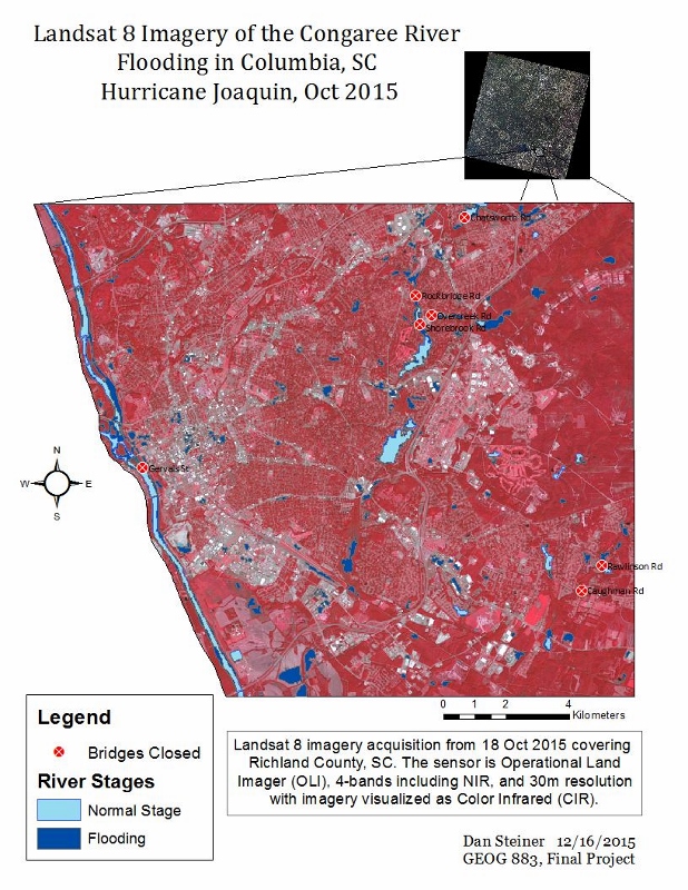
Flooding Analysis: Landsat Imagery
Flooding of the Congaree River during H. Joaquin (Columbia, SC in Oct 2015).
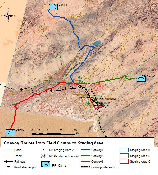
Convoy Route Planning
Optimizing Road and Rail transportation routes (Afghanistan).
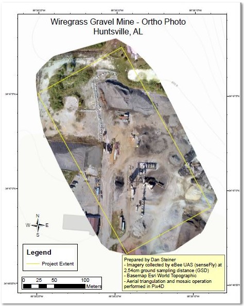
Unmanned Aircraft System (UAS) Products
Ortho Photo following post-processing & ground registration (Huntsville, AL).
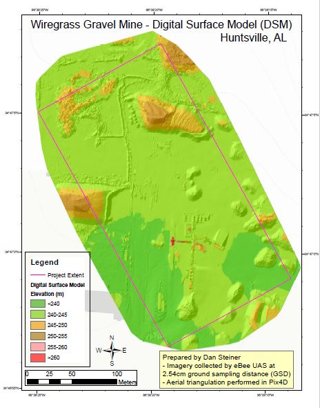
Unmanned Aircraft System (UAS) Products
Digital Elevation Model for gravel planning & operations (Huntsville, AL).